Aerial Mapping, LiDAR &
3D Modeling Across the Midwest
Stop relying on estimates. We transform physical sites into centimeter-accurate virtual assets. Whether you need a photorealistic model of a building or a topographic map of a forest, we use the specific sensor required to capture the absolute reality of your site.
Your Professional Data Partner
We function as a specialized data acquisition partner, supplying the high-quality aerial data that your licensed surveyor or engineer can trust, allowing them to focus on certification and analysis. You get the verifiable clarity and technical context you need—without the guesswork.
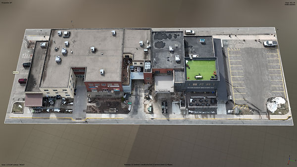
Photogrammetry (3D Modeling)
Best For: Visual Inspections, Aesthetics, & Building Envelopes.
How It Works: We use high-resolution cameras to capture thousands of overlapping images, stitching them into photorealistic 3D models.
Perfect Applications:
✅ Construction: Progress monitoring & As-builts.
✅ Forensics: Photorealistic accident scenes.
✅ Condition: Visualizing rust, cracks, & facades.
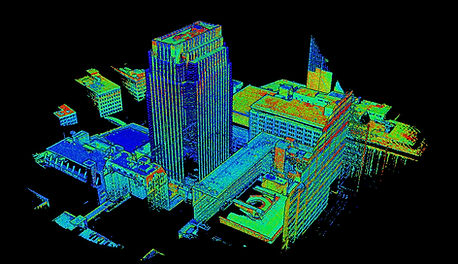
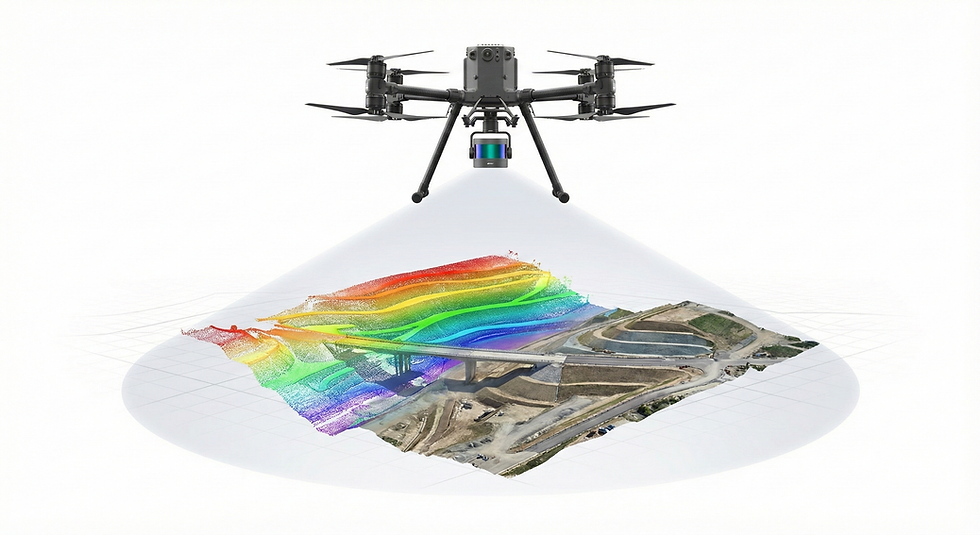
LiDAR Scanning (Laser)
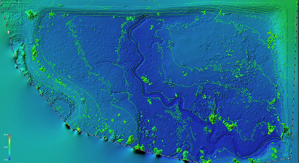
Best For: Topography, Dense Vegetation, & Complex Engineering.
How It Works: We use active laser sensors to fire millions of pulses per second, penetrating tree canopies to measure the true ground level.
Perfect Applications:
✅ Surveying: Mapping overgrown/wooded land.
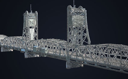
✅ Engineering: Powerlines & thin wire detection.
✅ Grading: Precise drainage & slope analysis.